El Niño Is Back: What It Means for South Africa's Weather
El Niño has officially returned, and forecasters warn it could become one of the strongest on record. Here's what that means for South Africa's drought risk, rainfall and water supply this summer.
If you've noticed the past couple of summers felt unusually wet and green, and you're now hearing weather presenters use the words "El Niño" again, you're not imagining things. In an update issued on 3 August 2026, the World Meteorological Organization said El Niño is developing and continuing to intensify steadily, on track to reach strong intensity during August to October and to peak between November 2026 and February 2027. UN Secretary General António Guterres put it more bluntly: "El Niño is not just on our doorstep; it is inside the house and turning up the heat."
For South Africa, that's not a small thing. The last strong El Niño, in 2015 and 2016, produced what South African authorities called the country's worst drought in 23 years, cutting the national maize crop by roughly a third. Cape Town's own water crisis unfolded around the same time, but as we'll get to, that one had more to do with three back to back dry winters than with El Niño itself. So it's worth understanding, in plain terms, what El Niño actually is, why it matters so much here, and what this particular one looks like so far.
What El Niño actually is
El Niño isn't a storm or a single weather event. It's a shift in ocean temperature thousands of kilometres away, in the tropical Pacific, that ends up rearranging weather patterns across much of the planet, South Africa included.
Under normal conditions, strong trade winds blow from east to west across the Pacific, piling up warm surface water near Indonesia and Australia while cooler water wells up along the coast of South America. During an El Niño, those trade winds weaken, and sometimes even reverse. Without them holding the warm water in the west, it sloshes back eastward across the Pacific, and the ocean surface off South America warms significantly. That single shift changes where rain clouds form and where dry air sinks, and the ripple effects reach as far as southern Africa, India, Australia and the Americas. Meteorologists call this a "teleconnection," which is really just a fancy word for the idea that the ocean in one hemisphere can quietly decide whether a farmer in the Free State gets rain in January.
El Niño and its opposite number, La Niña, alternate every few years as part of what's known as the El Niño Southern Oscillation, or ENSO. They're mirror images of each other: La Niña cools the eastern Pacific and tends to bring South Africa's summer rainfall regions above normal rain, while El Niño warms the same waters and tends to dry them out. South Africa has just come off a run of La Niña seasons, which is part of why the last couple of summers brought decent rain and, in places, fuller dams, and why the switch to El Niño is such a noticeable change in direction.
How El Niño usually plays out in South Africa
South Africa sits in a part of the world where El Niño's effect is fairly consistent, even if never guaranteed. Across the summer rainfall regions, which cover most of the country including the Free State, North West, Gauteng, Mpumalanga, Limpopo, KwaZulu-Natal and the eastern parts of the Eastern Cape, El Niño tends to mean a hotter, drier summer than normal. Rain systems that would normally push in from the Indian Ocean get blocked or weakened, cloud cover thins out, and daytime temperatures run higher for longer stretches. That's the maize belt, largely, which is why El Niño years so often show up first in grocery prices.
The Western Cape's winter rainfall region is a more complicated story. As Cobus Olivier, a prediction scientist at the South African Weather Service, has explained, the southwest's winter rain comes from mid latitude cyclones spinning off the Southern Ocean, a different system to the one El Niño disrupts over the interior. That distinction matters, because a strong El Niño doesn't automatically mean a Cape Town drought the way it does for the maize belt. Even so, forecasters have flagged a drier than normal autumn and winter for the southwest this year, worth watching given the province's still fresh memory of Day Zero.
There is one part of the country that tends to buck the trend. The eastern coastal strip around KwaZulu-Natal sometimes sees above normal winter rainfall during El Niño years, the flip side of the drying that hits the interior.
What this year's event actually looks like
By mid July, the World Meteorological Organization put the odds of El Niño persisting to at least November above 90%. Three weeks later, the WMO's 3 August update confirmed conditions were continuing to intensify steadily, with sea surface temperature anomalies in the key Pacific monitoring regions expected to exceed 2.9°C during August to October, a big number in a system where even small shifts move continents' worth of weather.
For South Africa, SAWS forecasters have been warning of above normal temperatures from August through December, with a higher chance of heatwaves and days over 40°C across the summer rainfall regions. Rainfall is always the harder part to call this far out, but the risk is tilted toward below normal totals over the maize belt heading into the 2026/27 growing season.
What makes forecasters more cautious than usual this time is the backdrop. Global temperatures are already sitting around 1.5°C above pre-industrial levels, and no one has watched a strong El Niño unfold on top of a baseline this warm before. That combination is what's driving comparisons to the 1997/98 and 2015/16 events, both remembered as some of the most disruptive El Niño years on record.
It's worth adding an honest caveat here, because forecasters do. El Niño doesn't produce the same result every time. In 1997/98, despite a very strong event, southern Africa actually came through with near normal rainfall in many areas, catching forecasters off guard. Local geography, moisture already in the soil, and the exact sea surface pattern all shape the outcome, so "El Niño is here" is a strong signal, not a guarantee of drought.
Why 2015/16 still matters
The most useful comparison remains the 2015/16 El Niño. South African authorities called it the country's worst drought in 23 years, while the UN's Food and Agriculture Organization described the wider regional drought as southern Africa's worst in more than three decades. Whichever way you scope it, the numbers were brutal: South Africa's maize harvest fell by around a third that season, cattle herds thinned as grazing dried up, and food price inflation jumped from 4.6% to 6.4% within a year.
Cape Town's water crisis unfolded alongside that drought but, as explained above, wasn't driven by the same mechanism. What hit the city was three consecutive weak winter rainy seasons from 2015 to 2017, a rainfall deficit that research has linked to the long term poleward shift of southern Africa's storm tracks and found was made five to six times more likely by climate change. Those winters happened to overlap with the 2015/16 El Niño without being caused by it. Dam levels fell so far that the city planned to shut off household taps in what became known as "Day Zero," a crisis narrowly avoided in 2018 through drastic water restrictions and, eventually, rain.
That history is exactly why this year's forecast is being taken seriously rather than dismissed as another cycle. The country does, however, enter this El Niño from a somewhat stronger position than it did in 2015. Recent La Niña seasons have left soil moisture and groundwater levels healthier in many summer rainfall areas, and grain stocks are more comfortable than they were heading into the last major drought. Agricultural economists tracking the situation say that cushion should soften the blow, even if it won't cancel it out.
Who feels it first
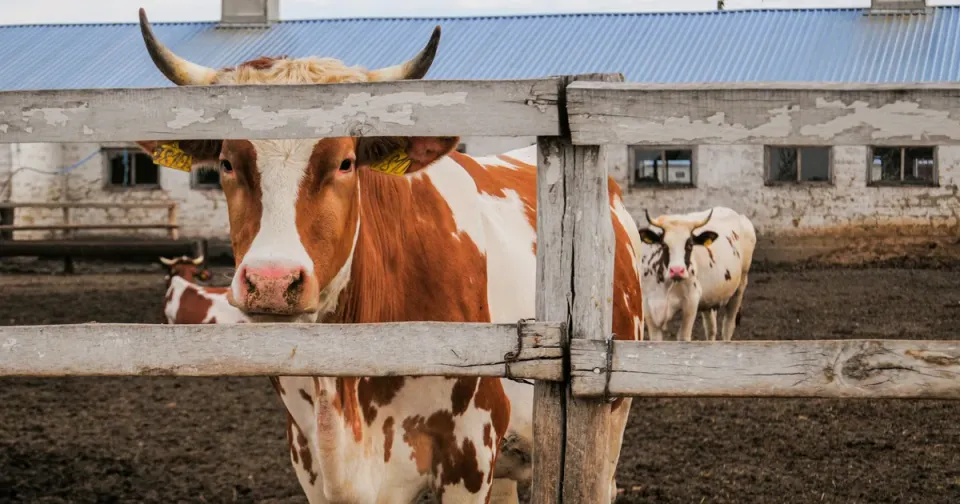
Farmers are usually the earliest to feel an El Niño season, through drier planting conditions and the harder calls that come with them, like which fields to plant and which to leave fallow. Municipal water managers watch it closely too, particularly in areas still carrying low dam levels from previous dry spells. Health authorities flag it for a different reason: prolonged heat and more frequent heatwaves put pressure on elderly people, outdoor workers and anyone without reliable access to shade or water. And because El Niño years tend to nudge food prices and interest rate decisions, the effects eventually show up well beyond the farm gate, in the numbers the South African Reserve Bank watches when it sets interest rates.
None of that is a reason for panic. It's a reason to plan. Farmers adjusting crop choices and conserving soil moisture, municipalities fixing leaks and firming up water restriction plans, and households simply being aware that this summer may run hotter and drier than the last two, are all sensible responses to a forecast that has become significantly more confident over the past few months.
Quick answers about El Niño and South Africa
What is El Niño, in one sentence?
It's a periodic warming of the central and eastern tropical Pacific Ocean that shifts rainfall and temperature patterns worldwide, including over southern Africa.
Is El Niño actually happening in South Africa right now?
Yes. As of the World Meteorological Organization's update on 3 August 2026, El Niño conditions are developing and continuing to intensify steadily, on track to reach strong intensity during August to October 2026.
What's the difference between El Niño and La Niña for South Africa?
They're opposite phases of the same Pacific Ocean cycle. La Niña tends to bring South Africa's summer rainfall regions above normal rain, while El Niño tends to bring hotter, drier conditions to the same areas. The country has just come off a run of La Niña seasons.
When did this El Niño start affecting South Africa?
Ocean conditions began shifting around May 2026, earlier than the usual July to September window, and by early August the World Meteorological Organization said the event was continuing to intensify steadily on its way to strong intensity.
Does El Niño always mean drought in South Africa?
No. It raises the odds of a hotter, drier summer over the interior, but the 1997/98 event showed rainfall can still come in near normal. It's a strong tilt in the odds, not a certainty.
Could Cape Town face another Day Zero?
El Niño's link to the Western Cape's winter rainfall is weaker than its link to the summer rainfall interior, since Cape Town's rain comes from a different system. Forecasters have flagged a drier than usual autumn and winter for the southwest this year, so dam levels are worth watching, but the direct mechanism that hit the interior so hard in 2015/16 isn't the one that caused Day Zero.
How long will this El Niño last?
As of early August 2026, the World Meteorological Organization expects it to peak between November 2026 and February 2027 before gradually fading.
Sources
- World Meteorological Organization, "Strong El Niño expected to intensify," 3 August 2026
- Daily Maverick, "Weather Watch: El Niño may emerge soon, dry winter seen for southwest SA," May 2026
- Daily Maverick, "History suggests a 'Godzilla' El Niño could be on our doorstep," May 2026
- IOL, "South Africans told: brace for a scorching summer as powerful El Niño returns," July 2026
- Mail & Guardian, "Preparing for El Niño," July 2026
- FAO, "El Niño set to have a devastating impact on southern Africa's harvests and food security"
- World Weather Attribution, "The role of climate change in the 2015-2017 drought in the Western Cape of South Africa"
What do you think?
Join the conversation on our South African community forum. Share your perspective, ask a question, or just say hello.